
Published October 16, 2026
Golf, Parks, and Open Space: Outdoor Recreation Geography for Las Vegas Relocations

Red Rock Canyon National Conservation Area recorded roughly 2.1 million visits in the Bureau of Land Management's 2024 fiscal year, and Lake Mead National Recreation Area logged more than 6.1 million recreation visits in 2025. For relocating luxury clients, those federal lands, together with Tule Springs, the Spring Mountains, and the valley's municipal parks and golf courses, form the outdoor geography surrounding every address under consideration. Below is a descriptive map of that geography from official sources as of mid-October 2026. I do not rank neighborhoods; I provide verified facts for your client conversations.
Western Rim: Red Rock Canyon and the Spring Mountains
Red Rock Canyon National Conservation Area, managed by the Bureau of Land Management, covers approximately 198,000 acres about 17 miles west of the Las Vegas Strip on Charleston Boulevard / State Route 159. Recreation.gov describes a 13-mile one-way Scenic Drive with twelve parking areas and twenty-one trails. Timed-entry reservations are required for Scenic Drive vehicle entry from October 1 through May 31; from June 1 through September 30, entry is handled at the fee station without a timed reservation. The BLM’s FY2024 Annual Manager’s Report recorded overall visitation of approximately 2,093,084 that fiscal year, with about 44 percent at the Scenic Drive fee booth. The same report notes roughly 50 miles of singletrack for non-motorized use and 16 miles of primitive roads for motorized use in the La Madre Foothills—adjacent to City of Las Vegas parks and western-edge housing.
Farther northwest, the Spring Mountains National Recreation Area within the Humboldt-Toiyabe National Forest spans 317,000 acres. Elevations range from about 3,000 feet in the valleys to 11,918 feet at Charleston Peak. The U.S. Forest Service reports more than a million visitors each year. Kyle Canyon picnic and trail facilities are described as roughly 30 miles from Las Vegas, placing this alpine-to-desert gradient within a day trip of Summerlin and western-rim addresses.
Eastern and Southern Edge: Lake Mead and the River Mountains
Lake Mead National Recreation Area covers approximately 1.5 million acres of mountains, canyons, valleys, and two reservoirs—Lake Mead and Lake Mohave—in Nevada and Arizona. The National Park Service recorded 6,135,586 recreation visits in calendar year 2025, tenth among all National Park System sites that year. NPS activities include scenic drives, hiking, biking, boating, fishing, and camping.
The River Mountains Loop Trail connects Lake Mead NRA, Hoover Dam, Henderson, Boulder City, and the broader valley: a paved, non-motorized loop totaling 34 miles, of which 16.2 miles lie inside Lake Mead NRA. NPS notes a 2010 National Recreation Trail designation and about 750 feet of elevation change. For a client comparing Henderson with the western rim, that trail and the NRA boundary are eastern geography—not a preference ranking.
Northwest Rim: Tule Springs and Ice Age Fossils State Park
North of Las Vegas and North Las Vegas, Tule Springs Fossil Beds National Monument covers approximately 22,650 acres. Established December 19, 2014 as the 405th unit of the National Park System, it preserves Pleistocene resources in the Upper Las Vegas Wash. NPS lists trailheads at Durango Drive and Moccasin Road and at Aliante Parkway and Moonlight Falls Avenue, with daylight hours and no on-site visitor center. Adjacent is Nevada’s Ice Age Fossils State Park in North Las Vegas—315 acres at 8660 N. Decatur Boulevard with a visitor center and short interpretive trails. Together they define a substantial open-space edge for Centennial Hills, Tule Springs, and other northwest addresses.
Municipal Parks, County Trails, and Golf Geography
City of Las Vegas Parks, Recreation and Cultural Affairs reports 87 parks totaling 1,787 acres and 217 trail miles in its 2025 Annual Report. The City of Henderson offers 77 parks. Clark County Wetlands Park spans 2,900 acres on the eastern edge of the valley, including a 210-acre Nature Preserve and five trailheads. Clark County’s trails program reports about 50 miles of completed multi-use trails and 8 miles of equestrian trails in the Las Vegas Valley, with 23 miles under development countywide, and points users to the Neon to Nature regional trail finder.
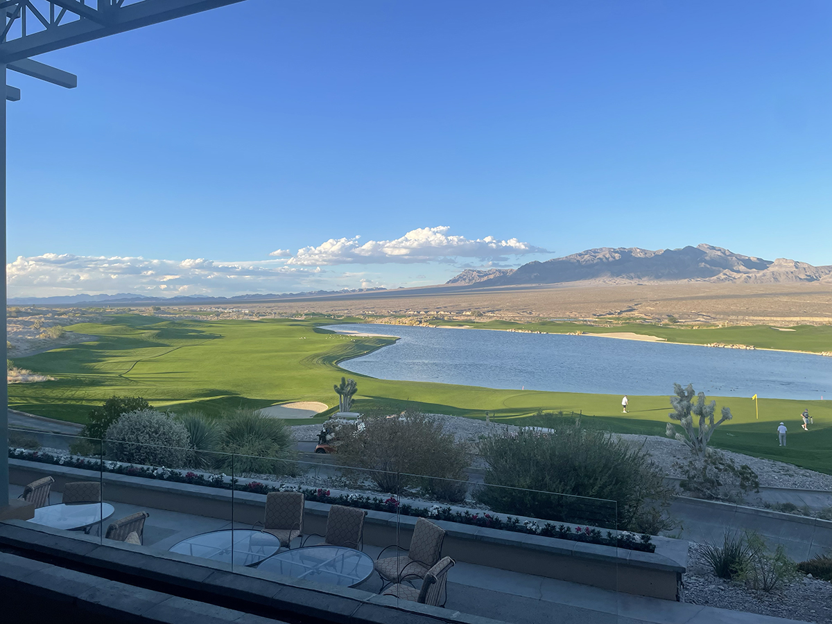
Golf is part of the same map. Travel Nevada states that Nevada has approximately 90 publicly accessible golf courses statewide, with southern Nevada play centered in Las Vegas, Henderson, Mesquite, and nearby communities. Courses and practice facilities sit throughout the valley—including along the western rim toward Red Rock, in Henderson and the southern valley, and at Tribal-operated resorts north of the urban core. I describe location relative to a given address; I do not rank clubs or steer toward a corridor.
How I Use This Map With Relocating Clients
When a client asks how outdoor recreation sits relative to a listing, I start with distance and jurisdiction: closer to Red Rock and the Spring Mountains, to Lake Mead and the River Mountains Loop, or to Tule Springs and the northwest wash? Which municipal parks and trail segments fall inside a realistic daily or weekend radius? When a client requests it, I can pair these facts with commute patterns and current housing inventory for the areas they are already considering—without characterizing any community as better or worse.
If you are relocating a luxury client to Las Vegas and need this outdoor-recreation geography for their search, I welcome the conversation. You can reach me at leah@eluciant.com or through Eluciant.com.
Sources: Recreation.gov, Red Rock Canyon Scenic Drive Timed Entry (acreage, 13-mile drive, 17 miles west of Strip, timed-entry seasons); Bureau of Land Management, Red Rock Canyon NCA FY2024 Annual Manager’s Report (visitation ~2,093,084; La Madre Foothills trail miles); National Park Service, Lake Mead NRA (≈1.5 million acres); NPS Office of Communications, March 13, 2026 (Lake Mead NRA 6,135,586 visits in 2025); NPS, River Mountains Loop Trail (34-mile loop; 16.2 miles in NRA; 2010 National Recreation Trail); U.S. Forest Service, Spring Mountains NRA (317,000 acres; Charleston Peak 11,918 ft; >1 million annual visitors); NPS, Tule Springs Fossil Beds NM Basic Information (22,650 acres; Dec. 19, 2014); Nevada State Parks, Ice Age Fossils State Park (315 acres); City of Las Vegas PRCA 2025 Annual Report (87 parks; 1,787 acres; 217 trail miles); City of Henderson Parks & Trails (77 parks); Clark County Wetlands Park (2,900 acres; 210-acre Nature Preserve); Clark County Trails Information (~50 miles multi-use; 8 miles equestrian; 23 miles under development); Travel Nevada Golf (≈90 publicly accessible courses statewide).
Featured photo: Heroesandhearts, Paiute Tribe Resort Las Vegas Landscape Golf Course, CC BY-SA 4.0, via Wikimedia Commons.


Leah Silva
Owner - Team Lead | Eluciant | Keller Williams The Marketplace
or another way